City News

City of Ashland, Oregon / Ashland Forest Resiliency Project / City News

Ashland Forest Resiliency Project News (View All)

Ashland Forest Resiliency Will Manage Two Controlled Burns on Wednesday, April 10th

On Wednesday, April 10th Ashland Forest Resiliency Partners will manage two controlled burns for community fire safety.
 
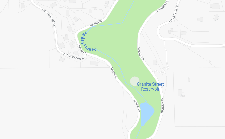
Above Lantern Hill Drive 
A controlled burn will be managed by the Ashland Forest Resiliency near upper Granite Street above Lantern Hill Drive.  Smoke could be in the surrounding area and on both sides of the TID Trail near Granite Street and Lantern Hill Drive.  
 
gs
Upper Granite Street

 
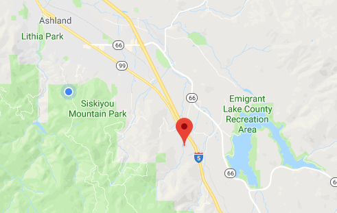
Windemar Drive
A pile burn will be conducted south of Ashland off Windemar Drive.  Smoke could impact the neighborhood around Windemar and Timberlake Drives. Smoke will be visible from Interstate 5 and on the south side of Ashland.
 
WD
Windemar Drive

Today is a Jackson County burn day and you may see burns at other locations.  You can now check the new Ashland Forest Resiliency watershed camera and webpage.   Thank you for your patience as we complete controlled burns to increase fire safety in and around our community.  

The Ashland Forest Resiliency Stewardship Project (AFR) is a 
collaborative forest restoration project that reduces the risk of severe wildfire across public and private land in and around the Ashland Watershed by thinning overcrowded forests and conducting controlled burns.

AFR


Online City Services

UTILITIES-Connect/Disconnect,
Pay your bill & more 
Connect to
Ashland Fiber Network
Request Conservation
Evaluation
Proposals, Bids
& Notifications
Request Building
Inspection
Building Permit
Applications
Apply for Other
Permits & Licenses
Register for
Recreation Programs

©2024 City of Ashland, OR | Site Handcrafted in Ashland, Oregon by Project A

Quicklinks

Connect

Share

twitter facebook Email Share
back to top