Ashland Forest Resiliency Project News (View All)
Controlled Burning Above Town at High Elevation
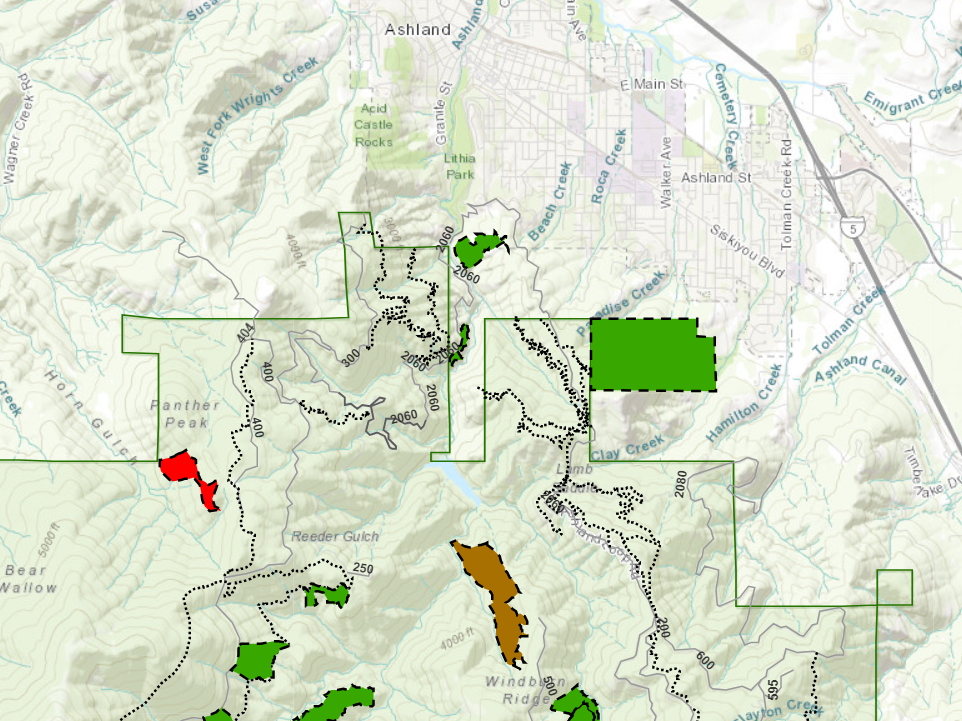
Tomorrow, on December 7, Ashland Forest Resiliency Project (AFR) is managing a high elevation controlled burn near Panther Peak. Smoke is not expected to impact the community. Some smoke could drift over the No Candies Trail.
Check weather and smoke on the watershed camera and see the burn location on the controlled burn map. See alternative recreation routes here.
Map of Controlled Burn Location
Check weather and smoke on the watershed camera and see the burn location on the controlled burn map. See alternative recreation routes here.
Map of Controlled Burn Location
Click here for a video about proactive fire planning to learn how controlled burning is helping make our forests healthier and our community safer in the face of increasingly hot and dry summers.
What To Do When There’s Smoke In the Air
Please close windows in the evening, and those sensitive to smoke should stay inside and use a HEPA quality air purifier if air quality declines. Our Smokewise Ashland site has all the resources you need to stay healthy when smoke is in the air.
To receive non-emergency burning and smoke alerts:
- Text WATERSHED in the message line to 888777 for non-emergency notifications
- Register for the AFR email
- Follow AFR on Facebook
- Learn more on our website
Online City Services
UTILITIES-Connect/Disconnect,
Pay your bill & more
Pay your bill & more
Connect to
Ashland Fiber Network
Ashland Fiber Network
Request Conservation
Evaluation
Evaluation
Proposals, Bids
& Notifications
& Notifications
Request Building
Inspection
Inspection
Building Permit
Applications
Applications
Apply for Other
Permits & Licenses
Permits & Licenses
Register for
Recreation Programs
Recreation Programs