Homepage News (View All)
City of Ashland GIS Award
The City of Ashland Honored with Special Achievement in GIS Award – GIS Technology Provider Esri recognized the City of Ashland at annual user conference.
Esri, the global leader in location intelligence, presented the City of Ashland’s Fire Adapted Ashland program with the Special Achievement in GIS (SAG) Award on July 12, 2023, at the annual Esri User Conference (Esri UC) in Redlands, CA. Selected from hundreds of thousands of users, the City of Ashland received the award for its innovative use of mapping and analytics technology, as well as leadership in GIS Analysis in support of wildfire adaptation. The SAG Award is intended to demonstrate an appreciation for organizations around the world that are using geographic information system (GIS) technology to understand vast amounts of data and solve complex problems.
"Users across all industries continue to show the groundbreaking possibilities of what GIS can help them accomplish," said Jack Dangermond, Esri founder and president. "I am honored to recognize all the organizations for the many ways they are taking a geographic approach toward meeting some of the most pressing challenges our world faces today."
The City of Ashland Fire Department’s Wildfire Division is tasked with identifying and mitigating wildfire risk in and around Ashland and its municipal watershed. The team used GIS to better understand landscape and built environments, highlight regions in the city with elevated risk, and put together programs in support of specific actions that mitigate wildfire potential. Using GIS modeling, staff were able to synthesize fire risk on a per-parcel scale based on a variety of environmental factors related to slope, aspect, vegetation, proximity to other structures and exposure to wildland fuels. Ashland Fire & Rescue is currently working on an update of the analysis to provide a current snapshot of wildfire risk.
“Ashland has done a lot of work over the past two decades to understand our wildfire risk and reduce that risk by working with citizens and partner organizations. Using technology like GIS to refine our risk profile helps us more effectively find mitigation funding and invest where we’ll get the greatest risk reduction for our investment,” said Chris Chambers, Wildfire Division Chief.
Chambers added, “We’re honored to be recognized for our use of GIS to protect our citizens, property and infrastructure from wildfires we know will impact our community in the future. GIS technology is critical to the safety of our community.”
The risk assessment GIS project directly resulted in the City being awarded $3 million in pre-disaster mitigation funds from the Federal Emergency Management Agency, or FEMA. This grant is being used to help the highest risk properties in Ashland to lower their risk by removing flammable plants and replacing wood shake roofs. So far, 11 wooden roofs have been replaced and 250 properties have reduced their risk by removing flammable plants.
“We are deeply honored to receive this prestigious award. It is a testament to the countless hours of dedication and the unwavering passion we have for harnessing the power of spatial data to address complex challenges,” said Jason Wegner, Director of Innovation and Technology for the City. “GIS is not just about maps; it's about making a difference. This award acknowledges the impact that innovative geospatial solutions can have on society, and it motivates us to continue pushing the boundaries of what is possible.”
A total of 200 organizations from the commercial industry, defense, transportation, nonprofit work, telecommunications and government sectors were honored. Esri staff annually nominate hundreds of candidates from around the world for consideration, and Dangermond selects the finalists.
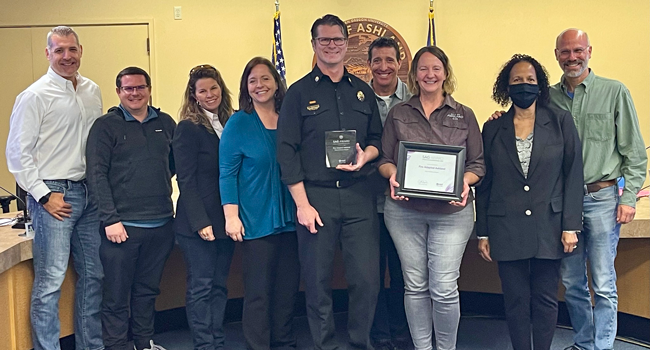
GIS Manager for the City, Lea Light Richards, and Chris Chambers presented the award to the Ashland City County at the October 17, 2023, Business Meeting. Richards acknowledged City staff who contributed to the success of the mapping project: Rickey Fite, Senior GIS Analyst, and Brian Hendrix, Fire Adapted Communities Coordinator. For another example of how the City of Ashland is setting the trend in the use of geospatial technology to reduce wildfire risk and educate the public, visit the Ashland Forest Resiliency Project Story Map.
#end
About Esri
Esri, the global market leader in GIS software, location intelligence, and mapping, helps customers unlock the full potential of data to improve operational and business results. Founded in 1969 in Redlands, California, USA, Esri software is deployed in hundreds of thousands of organizations globally, including Fortune 500 companies, government agencies, nonprofit institutions, and universities. Esri has regional offices, international distributors, and partners providing local support in over 100 countries on six continents. With its pioneering commitment to geospatial technology and analytics, Esri engineers the most innovative solutions that leverage a geographic approach to solving some of the world’s most complex problems by placing them in the crucial context of location. Visit us at esri.com.
“We are Better Together!”
CONTACT:
Jason Wegner, GISP, Director Innovation and Technology
City of Ashland
541.552.2417
jason.wegner@ashland.or.us
Released October 18, 2023
Online City Services
UTILITIES-Connect/Disconnect,
Pay your bill & more
Pay your bill & more
Connect to
Ashland Fiber Network
Ashland Fiber Network
Request Conservation
Evaluation
Evaluation
Proposals, Bids
& Notifications
& Notifications
Request Building
Inspection
Inspection
Building Permit
Applications
Applications
Apply for Other
Permits & Licenses
Permits & Licenses
Register for
Recreation Programs
Recreation Programs