Ashland Forest Resiliency Project News (View All)
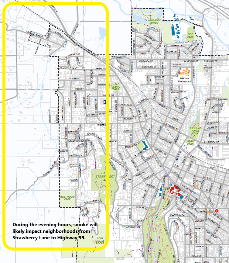
West Ashland: Controlled Burn Above Ashland Mine Road
The Ashland Forest Resiliency is having a controlled burn this morning that Lomakatsi Restoration Project and Grayback Forestry, Inc. will manage under safe and desired conditions. It has been too wet over most of the area up until now. Crews will be closely watching conditions to ensure firefighter and community safety because this is our top priority. The controlled burn is located above Ashland Mine Road, west of Ashland and will not directly impact roads or trails.
Smoke is Very Likely to Impact the Community:
- Smoke can drift into the watershed and cause issues for trail users, and you will see smoke during the day throughout the Rogue Valley.
- In the evening hours, smoke will very likely impact neighborhoods from Strawberry Lane all the way to neighborhoods down to Valley View Road and along Hwy 99 including Westwood, upper Wimer and Ashland Mine Road for a brief time. As cooler air drops into the valley, the smoke can be pulled to lower elevations, so please take precautions.
- Recommended Actions: Stay inside, close windows, turn on HEPA or other air filters, and wear a N95 respirator when smoke is present. See www.smokewiseashland.org for additional health recommendations.
- Stay updated at www.ashlandwatershed.org
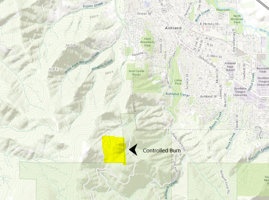
Controlled Burn Location:
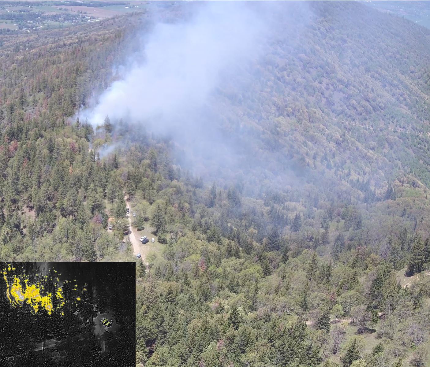
Drone Monitoring: Crews who manage smoke and fire conditions are monitoring from the ground level to above the controlled burn using a drone. In the photo below, you can see recent drone monitoring that happened as the prescribed fire progressed on May 17th.
- For burn day text notifications, text the word "WATERSHED" in the message line to 888777 as the recipient. You will get an auto-confirmation text when you sign-up. You can also download the Everbridge/Nixle app to get alerts.
- Ashland Forest Resiliency website
- Sign-up for email alerts at ashlandwatershed.org
- AFR Facebook
- Smoke and Health Info: smokewiseashland.org
- See controlled burns on the watershed camera
.jpg)
Online City Services
UTILITIES-Connect/Disconnect,
Pay your bill & more�
Pay your bill & more�
Connect to
Ashland Fiber Network
Ashland Fiber Network
Request Conservation
Evaluation
Evaluation
Proposals, Bids
& Notifications
& Notifications
Request Building
Inspection
Inspection
Building Permit
Applications
Applications
Apply for Other
Permits & Licenses
Permits & Licenses
Register for
Recreation Programs
Recreation Programs