Click on the Controlled burn map to see locations where the Ashland Forest Resiliency is conducting controlled burning.
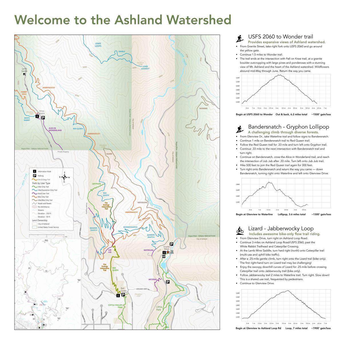
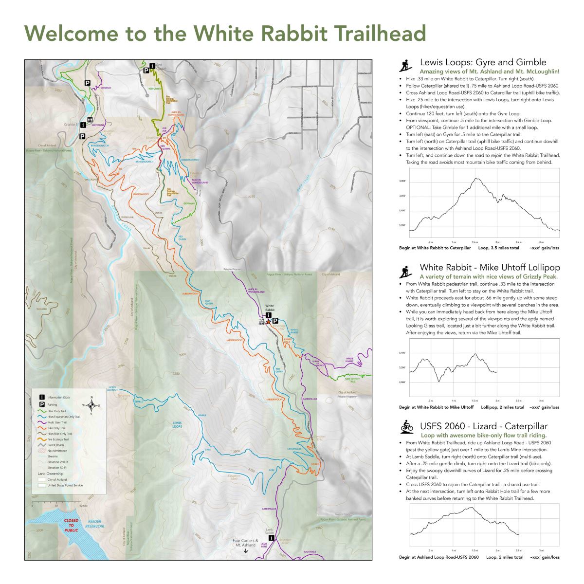
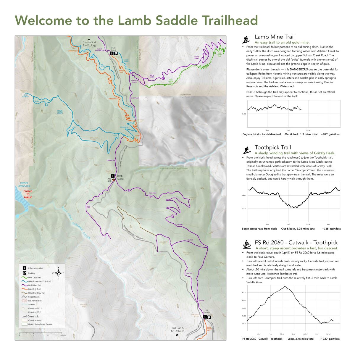
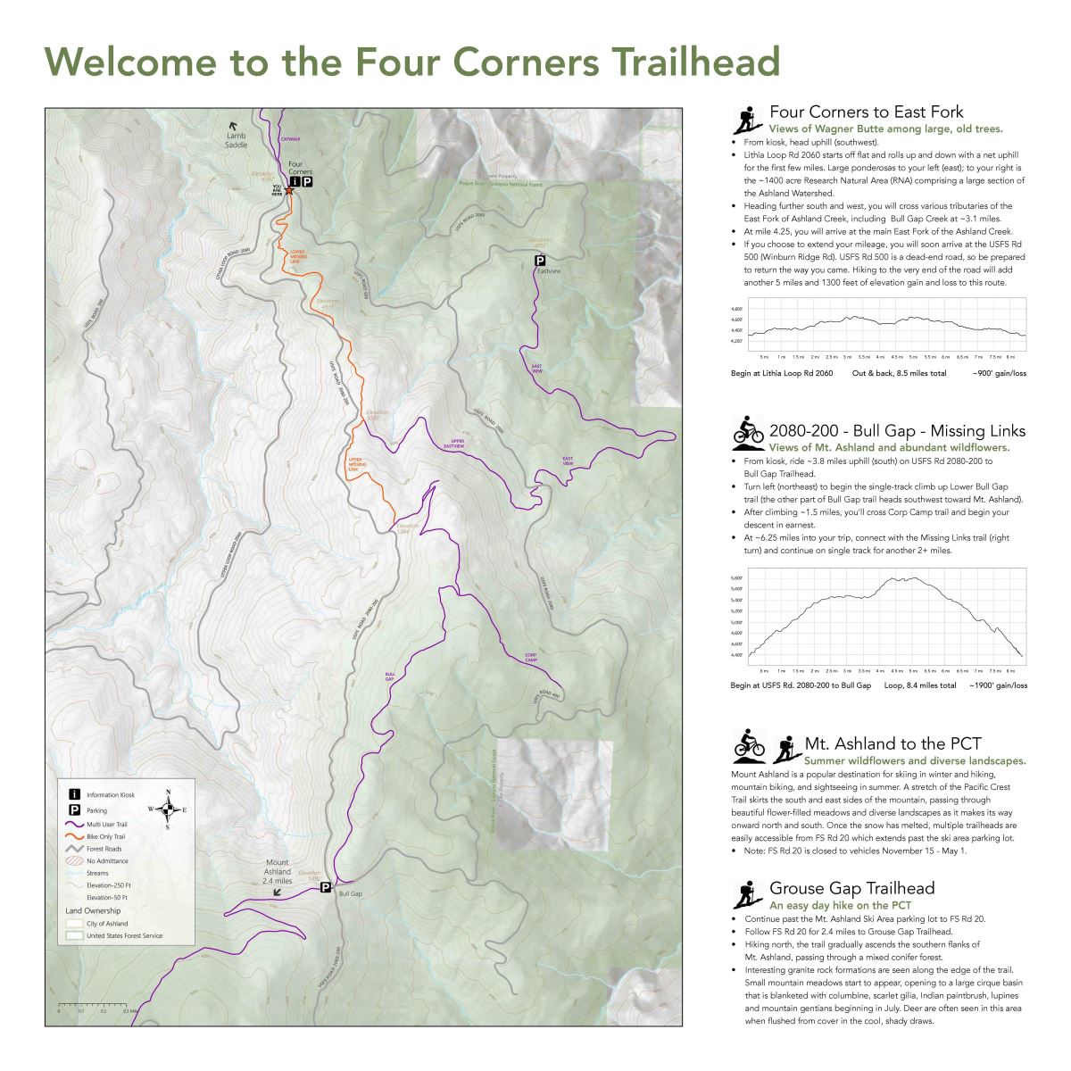
Trail Maps - Click on Maps to View/Download the .PDF
Granite Reservoir
White Rabbit
Lamb Saddle
Four Corners
Click here and scroll down to "AFR Maps" to view the trails on City property and Forest Service lands in the Ashland Watershed.
Ashland Forest Resiliency Project Map.jpg) |