Buildable Lands Inventory
The City of Ashland approved an update to the Buildable Lands Inventory (BLI) on January 21st, 2020.
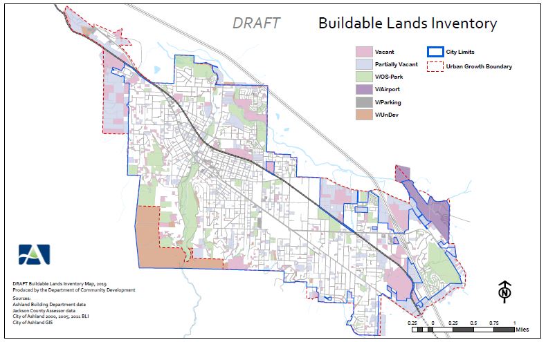 This technical document, and corresponding BLI map, provides detailed information regarding the amount of buildable lands within the City's urban growth boundary as of July 2019.
 The process of conducting a Buildable Lands Inventory is essentially an exercise in quantifying available land suitable for development within the geographic or political boundary (city limits, Urban Growth Boundary).
Under statewide planning goals a land component of a BLI is utilized to assess whether the Urban Growth Boundary (UGB) contains enough land to satisfy the community’s 20 year housing and commercial land needs. The inventory should not be construed to mean all properties identified are presently "readily developable", but rather over the next 50 years are likely to become available for development.
The Buildable Lands Inventory (BLI) , Resolution 2020-01 , and 2019 BLI Map were presented at public hearings for adoption on the following dates:
Online City Services
UTILITIES-Connect/Disconnect,
Pay your bill & more
Pay your bill & more
Connect to
Ashland Fiber Network
Ashland Fiber Network
Request Conservation
Evaluation
Evaluation
Proposals, Bids
& Notifications
& Notifications
Request Building
Inspection
Inspection
Building Permit
Applications
Applications
Apply for Other
Permits & Licenses
Permits & Licenses
Register for
Recreation Programs
Recreation Programs