Controlled Burning Continues on Tuesday March 9th for Winburn Ridge in the Ashland Watershed
On Tuesday (3/9/21), the AFR Partners plan to do a controlled burn of debris piles to lessen fire danger in the Ashland Watershed along USFS 2060-500 spur and Winburn Ridge. No trails or roads will be closed however the 2060-500 road will have areas with heavy smoke impacts during the pile ignition. This area is remote from popular trails so we don’t expect any recreation impacts.Thank you for the continued patience as we continue to do the important work of removing these excess fuels from the Ashland watershed.
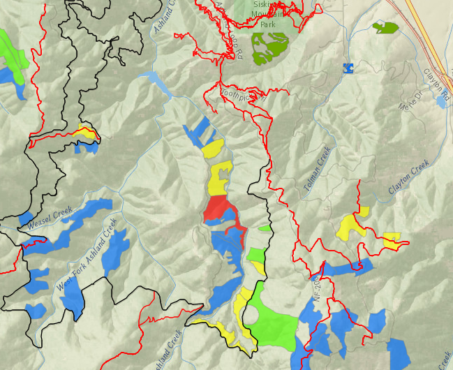
Smoke will be visible but should not impact any populated areas.
USFS 2060-500 could have some smoke
Controlled Burn Continues Adjacent to USFS Road 2060-500 and Winburn Ridge
Areas highlighted in red are active controlled burns
Those highlighted in yellow were recently burned and being monitored
Blue areas are planned controlled burns
Green represents completed burns
More Information
For burn day notifications, text the word "WATERSHED" in the message line to 888777 as the recipient. You will get an auto-confirmation text when you sign-up. Download the app: Nixle Phone Application through Everbridge to receive daily messages.