Ashland Forest Resiliency Project News (View All)
Controlled Burning Planned for Wednesday, January 6th in the Panther Peak Area Above Talent and West Ashland
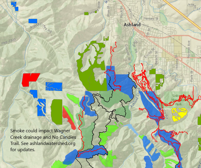
On Wednesday, January 6th, the Ashland Forest Resiliency Partners plan to do controlled burning in the Panther Peak area and up Wagner Creek Road. No trails or roads will be closed; however, the No Candies Trail could have some smoke impact and areas around upper Wager Creek Road. Rogue River-Siskiyou National Forest crews and Lomakatsi Restoration Project will be on site to manage the controlled burning.
Potential Smoke Impact
-
Smoke will be visible from parts of west Ashland, Talent and from Interstate 5.
-
The controlled burning is located at high elevation and smoke impact is expected briefly near the controlled burn along the No Candies Trail during the day and the Wagner Creek area in the evening
More Information
- Text-based notifications: text the word "WATERSHED" in the message line to 888777 as the recipient. You will get an auto-confirmation text.
- AFR Facebook
- smokewiseashland.org
- See controlled burn on the watershed camera
- Burn locations can be accessed through an online map
Ashland Forest Resiliency partners and the community are celebrating 10 years of work in the watershed. Learn more about how controlled burning is restoring forests in Oregon.
Online City Services
Pay your bill & more�
Ashland Fiber Network
Evaluation
& Notifications
Inspection
Applications
Permits & Licenses
Recreation Programs