Two Highly Visible Controlled Burns Planned for Wednesday, February 12th: Above Hitt Rd and near Interstate 5 off Neil Creek Road
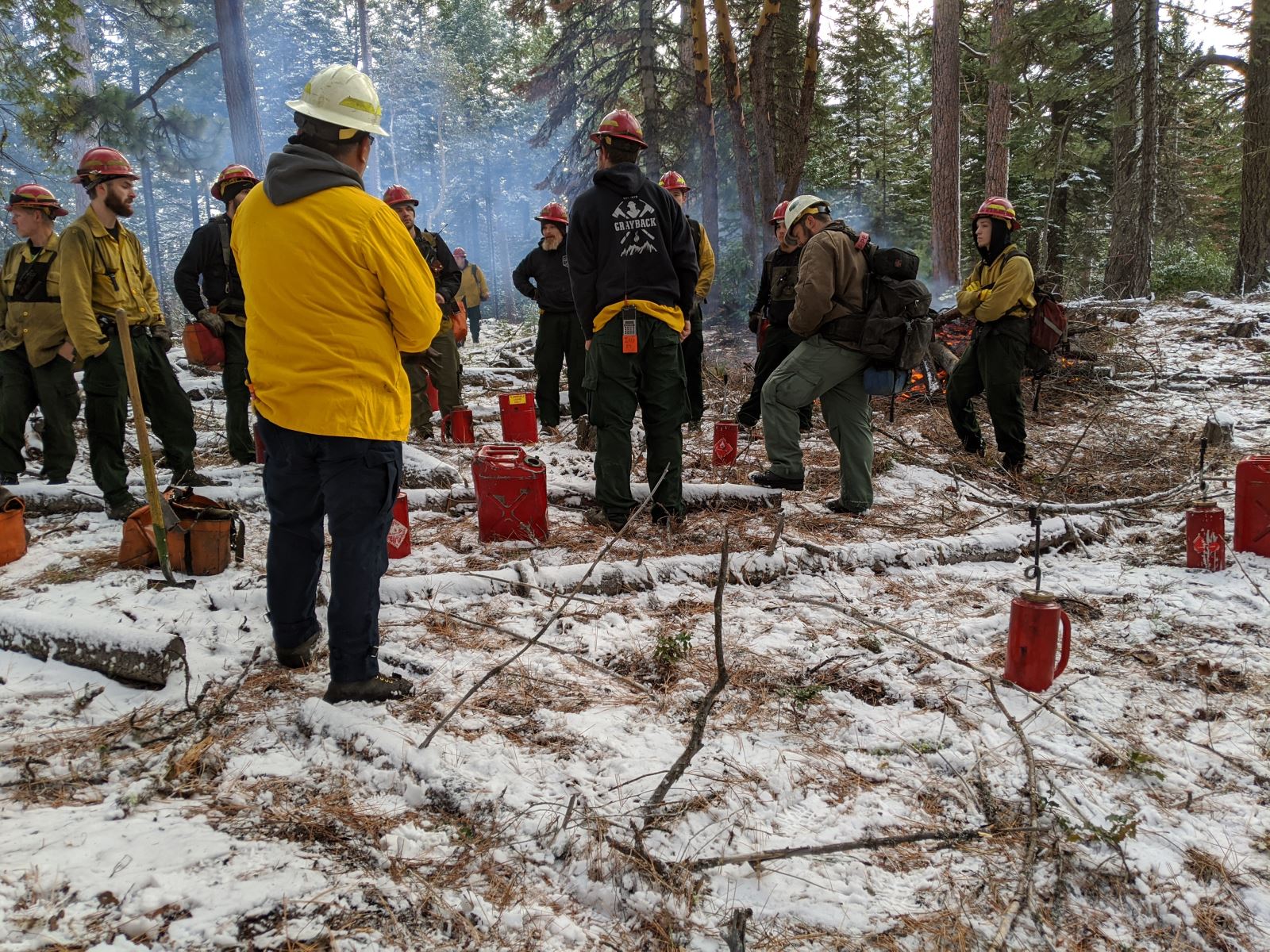
UPDATE -10:00 a.m.: Smoke is moving toward the upper Tolman Creek area. Toothpick and Eastview trails may have some smoke impact. We will give an update later this afternoon. Burn crews with Lomakatsi Restoration Project and Grayback Forestry, Inc. are getting some important forest projects completed today by introducing good fire!
Tomorrow, Wednesday, February 12th two controlled burns will be managed for community wildfire safety by the Ashland Forest Resiliency.
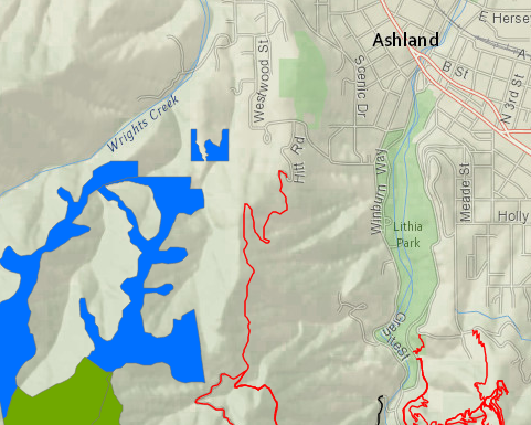
One of the burns is above Hitt Road area on the west side of town. This controlled burn is near Westwood Street and Strawberry Lane.
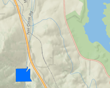
A second burn is located 1/4 mile east of Interstate 5 off Neil Creek Road. The controlled burn is about a mile east of Emigrant Lake and Highway 99.
Potential Smoke Impact
Smoke will be visible from many parts of town including Highway 99, and Interstate 5. No roads or trails will be closed, however, some smoke impacts could occur close to the controlled burns in neighborhoods near Strawberry Lane and Westwood Street. To avoid recreating in smoke, use alternate trails on the east side of the watershed up Tolman Creek Road or the Ashland Loop Road. Smoke sensitive people should avoid areas closest to the controlled burns.
Hitt Road, February 12th
Neil Creek Road Near Interstate 5, February 12th
Why We Conduct Burns
A recent article in the Ashland Daily Tidings explains more about why we use controlled burns. See 'Fighting Fire with Fire' for details.
More Information
If you live close to a burn location, keep windows closed and if you smell smoke, follow health recommendations on Smokewise Ashland.
Text based notifications: text the word "WATERSHED" in the message line to 888777 as the recipient. You will get an auto confirmation text.
Conditions for burning are good with a weather system that will move smoke away from town. Controlled burns are a critical part of creating a safer, more resilient landscape and community in the face of increasing fire risk due to climate change and overgrown forests. Find out more about why we burn.
Online City Services
UTILITIES-Connect/Disconnect, Pay your bill & more�