Ashland Forest Resiliency Project News (View All)
Controlled Burns Continue at Three Locations on Friday, November 30th
Three Controlled burns are scheduled with the Ashland Forest Resiliency Stewardship Project.
- Near the south end of Wagner Creek Road between Ashland and Talent (90 acres)
- Four miles above Ashland near the Lower Bull Gap Trail, Corp Camp and Upper missing Links Trail off the upper Tolman Creek Road crew will continue burns (129 acres)
- About five miles up the Mount Ashland Ski Road (10 acres)
See the newly updated controlled burn map for locations. Smoke may be visible between Ashland and Talent. Trails around Bull Gap may be smokey.
Stay informed on our controlled burns by signing up for text alerts, emails, or social media.
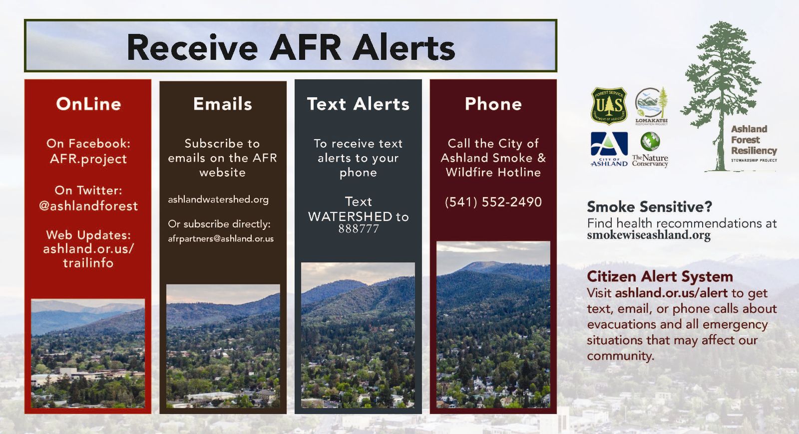
- AFR Mobile Alerts: Text the word WATERSHED in the message line to 888777 as the recipient.
- Call the Smoke & Wildfire Hotline: (541) 552-2490
- Follow us on Facebook
- Find us on Twitter
- Subscribe to AFR email
- See ashlandwatershed.org
Online City Services
UTILITIES-Connect/Disconnect,
Pay your bill & more�
Pay your bill & more�
Connect to
Ashland Fiber Network
Ashland Fiber Network
Request Conservation
Evaluation
Evaluation
Proposals, Bids
& Notifications
& Notifications
Request Building
Inspection
Inspection
Building Permit
Applications
Applications
Apply for Other
Permits & Licenses
Permits & Licenses
Register for
Recreation Programs
Recreation Programs