Ashland Forest Resiliency Project News (View All)
West Side of Ashland Watershed: Controlled Burning Continues at High Elevation
On Wednesday, December 7th, the Rogue River-Siskiyou National Forest will manage a controlled burn to consume burn piles on behalf of the Ashland Forest Resiliency project.
Predicted Smoke Impacts: Lowest Priority – Level 1
Where is Burning?
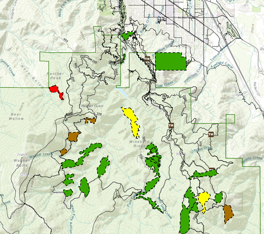
See the burn location in the online map, or highlighted in red below.
Why Burn?
Burning accumulated fuel is an important step to restore forest resilience and prevent severe summer wildfires in our municipal watershed and community. Our top priority when using prescribed fire is the safety and well-being of our community and fire crews. Learn more about how proactive fire planning is used to prioritize our work and guide summer fire response.
Stay in Touch.
Predicted Smoke Impacts: Lowest Priority – Level 1
| Location of Controlled Burn | Panther Peak area in upper watershed near USFS 2060 (west side of the watershed) |
| Date of Controlled Burn | Wednesday, December 7th |
| Potential Smoke Impacts |
No Candies Trail near the burn area and 2060 Road may have some drifting smoke and smoke could be visible from town if clearing allows |
| What to do for smoke | Smokewise Ashland has resources to help you stay healthy |
| More information | See project updates on the AFR webpage. |
Where is Burning?
See the burn location in the online map, or highlighted in red below.
Why Burn?
Burning accumulated fuel is an important step to restore forest resilience and prevent severe summer wildfires in our municipal watershed and community. Our top priority when using prescribed fire is the safety and well-being of our community and fire crews. Learn more about how proactive fire planning is used to prioritize our work and guide summer fire response.
Stay in Touch.
- Text WATERSHED in the message line to 888777 for non-emergency text notifications about AFR burns
- Register for the AFR email list
- Follow AFR on Facebook
- Find us on Twitter
- Learn more on our website
Online City Services
UTILITIES-Connect/Disconnect,
Pay your bill & more
Pay your bill & more
Connect to
Ashland Fiber Network
Ashland Fiber Network
Request Conservation
Evaluation
Evaluation
Proposals, Bids
& Notifications
& Notifications
Request Building
Inspection
Inspection
Building Permit
Applications
Applications
Apply for Other
Permits & Licenses
Permits & Licenses
Register for
Recreation Programs
Recreation Programs