Fire News (View All)
Containment Improves to 40% for Klamathon Fire
Klamathon Fire Update
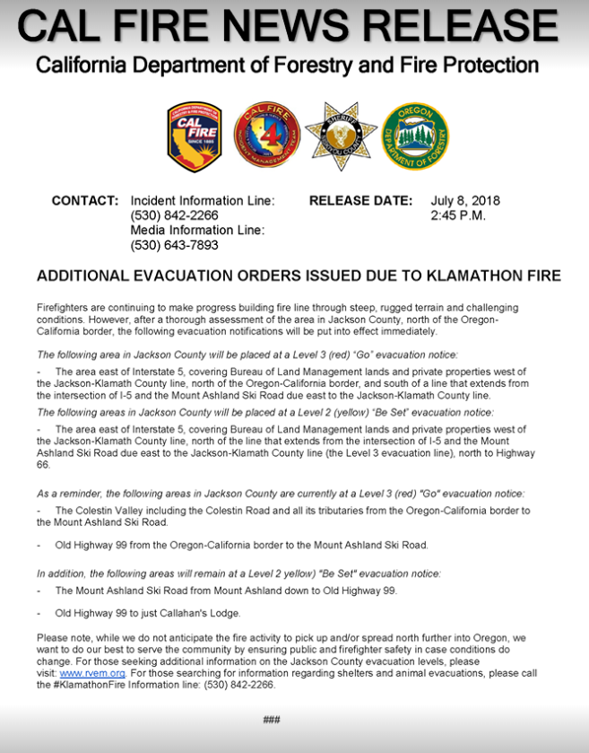
The fire has consumed 36,500+ acres and containment improved to 40%. During a community meeting held this evening Oregon Department of Forestry, CAL FIRE Incident Management Team 4, Siskiyou County Sheriff’s Office, Jackson County Sheriff’s Office, Rogue Valley Fire Chiefs, and BLM stated that fire lines are currently holding.
BLM Closure Order remains in effect.
Evacuation Levels Improve
Colestin Road, Old Highway 99 from the California border to Mt. Ashland Ski Road and Old Highway 99 to just Callahan's Lodge moved from a "Level 3" (GO) to "LEVEL 2" (BE SET).
Mt. Ashland Ski Road from the ski resort to Highway 99, and Highway 99 from Mt. Ashland Ski Road to the 6700-block is now at "Level 1" (BE READY) .
To stay informed locally with alerts from Nixle: Text 97520 to 888777.
For the most up-to-date Klamathon Fire information, follow these pages:
Cal Fire Siskiyou Unit's Facebook
Jackson County Sheriff's Office - Oregon's Facebook
ODF Southwest Oregon District's Facebook
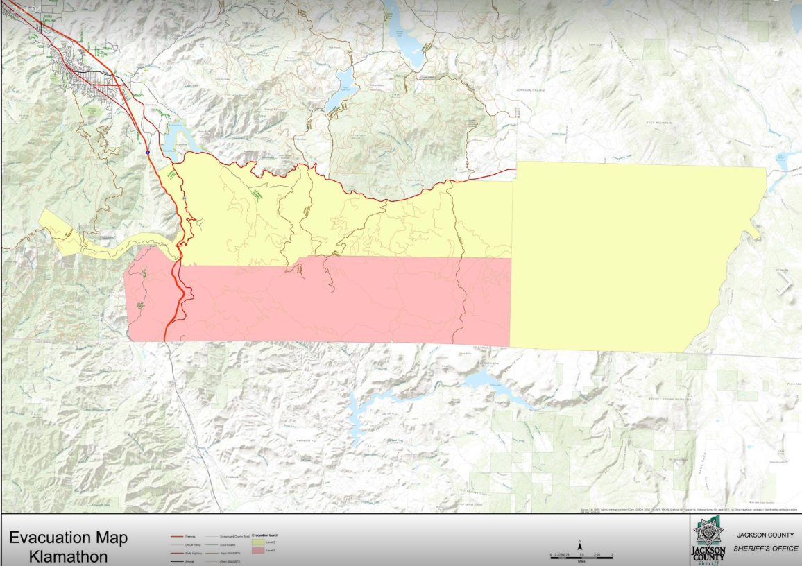
Evacuation Map: Level 3 in Red (Go) and Level 2 in Yellow (Ready)
.jpg)
The fire has consumed 36,500+ acres and containment improved to 40%. During a community meeting held this evening Oregon Department of Forestry, CAL FIRE Incident Management Team 4, Siskiyou County Sheriff’s Office, Jackson County Sheriff’s Office, Rogue Valley Fire Chiefs, and BLM stated that fire lines are currently holding.
BLM Closure Order remains in effect.
Evacuation Levels Improve
Colestin Road, Old Highway 99 from the California border to Mt. Ashland Ski Road and Old Highway 99 to just Callahan's Lodge moved from a "Level 3" (GO) to "LEVEL 2" (BE SET).
Mt. Ashland Ski Road from the ski resort to Highway 99, and Highway 99 from Mt. Ashland Ski Road to the 6700-block is now at "Level 1" (BE READY) .
To stay informed locally with alerts from Nixle: Text 97520 to 888777.
For the most up-to-date Klamathon Fire information, follow these pages:
Cal Fire Siskiyou Unit's Facebook
Jackson County Sheriff's Office - Oregon's Facebook
ODF Southwest Oregon District's Facebook
Online City Services
UTILITIES-Connect/Disconnect,
Pay your bill & more
Pay your bill & more
Connect to
Ashland Fiber Network
Ashland Fiber Network
Request Conservation
Evaluation
Evaluation
Proposals, Bids
& Notifications
& Notifications
Request Building
Inspection
Inspection
Building Permit
Applications
Applications
Apply for Other
Permits & Licenses
Permits & Licenses
Register for
Recreation Programs
Recreation Programs