Two Controlled Burns Planned on Saturday, December 7th
Two controlled burns are scheduled tomorrow, Saturday December 7th on the West side of the Ashland Watershed. Conditions for burning are good with predicted rains and weather systems that will move smoke away from town.
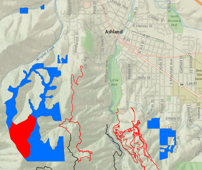
The first burn is located off the U.S. Forest Service Road 2060-200 (Horn Gap Road). Smoke could impact parts of Rickety, Horn Gap Road, USFS 2060, No Candies and Horn Gap Trail. Several alternative trails can be accessed on the East Side of the Watershed off Tolman Creek Road or the Ashland Loop Road.
AFR Burn Near USFS 2060-200 (Horn Gap Road)
A second burn is located above Ashland Mine Road. Smoke will be visible from several parts of the community. No road or trail impact is expected. If you live close to the burn location keep windows closed and if you smell smoke follow health recommendations on Smokewise Ashland. For locations of current and future burns, check the burn map.
Above Ashland Mine Road
Controlled burning is a critical part of creating a safer, more resilient landscape in the face of increasing fire risk due to climate change and overgrown forests. For more information and alerts, see below.
AFR is a ten-year stewardship project designed to reduce the risk of severe wildfire in the watershed and to protect water quality, older forests, wildlife, people, property and quality of life.
Online City Services
UTILITIES-Connect/Disconnect, Pay your bill & more�